
TrainerDay
›Nouvelle-Zélande›The Far Canal 200 km BRM|2026·1 458Événements
FR▾
EnglishENPolskiPLDeutschDEItalianoITFrançaisFREspañolESSlovenčinaSK日本語JAMagyarHUΕλληνικάELPortuguêsPTNederlandsNLČeštinaCSNorskNOSvenskaSVDanskDASuomiFIБългарскиBG
Connexion S'inscrire
Accueil Entraînement Événements Forums
MAR
29
SEP
Course à pied·10 km

Island Ultra

Nelson, NZ
SAM
3
OCT
Course à pied·5 km

McLaren Falls Trail, Tauranga 2026

Omanawa, NZ
SAM
3
OCT
Course à pied·32 km

Rakiura Challenge Trail Run

Oban, NZ
SAM
3
OCT
Course à pied

Rakiura Challenge Trail Run

, NZ
SAM
3
OCT
Course à pied

NZ Road Relay Championships

Whanganui, NZ
SAM
3
OCT
Course à pied·32 km

RealNZ Rakiura Challenge Trail Run

Stewart Island / Rakiura, NZ
SAM
3
OCT
Course à pied·5 km

Kiwi Walk & Run Series - McLaren Falls Trail Tauranga

Tauranga, NZ
SAM
3
OCT
Course à pied·2 km

Marina 2 Marina

Picton, NZ
DIM
4
OCT
Course à pied·5 km

Pink Ribbon Walk Christchurch

Christchurch, NZ
DIM
4
OCT
Course à pied·2.5 km

4 Paws Marathon

Christchurch, NZ
DIM
4
OCT
Course à pied·5 km

Harcourts Cooper & Co Devonport Half Marathon

Narrow Neck, NZ
DIM
4
OCT
Course à pied·2 km

Sri Chinmoy Auckland Series 2026: Race 8 - War Mem Pk, Mt Roskill ... 04Oct26

Mt Roskill, NZ
Nouvelle-Zélande 2026 · 1 458 événements ✕
Course à pied road

The Far Canal 200 km BRM 2026

SAM, Octobre 10, 2026 · Kaiaua , Nouvelle-Zélande

Distances

200 km

À propos de cette course

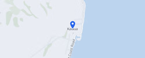
The Far Canal 200 km BRM begins at the Kaiaua Boat Club on New Zealand's Seabird Coast, offering participants 13.5 hours to complete a roughly 201 km sealed-road brevet. This audax-style ride has a modest entry fee and an optional medal package. The 200 km course features minimal elevation gain, totaling approximately 500 metres. The route heads north from Kaiaua along the coast, crosses the Hauraki Plains into north Waikato, passes Waihou, and extends to Wardville before returning. Control points are located at Kaiaua Boat Ramp, Waihou Dairy, Cafe 77 in Manawaru, and Kaiaua GAS, with Cafe 77 serving as the turnaround point. An alternative 300 km route is available, adding 376 metres of climbing and including controls at Morrinsville, Matamata, Ngatea, and Kaiaua. The organiser notes that the primary difficulty might be the wind, as hills are few, but a headwind can occur on both legs of the journey.
The Far Canal 200 km BRM © OpenStreetMap
Kaiaua
Kaiaua
Itinéraire
Rechercher sur Google

Météo typique OCT

23°C min 12°C
35mm précip moy
Chaud et agréable.

Veuillez vérifier les détails de l'événement avec l'organisateur avant de vous inscrire.

Modifier l'événement Ajouter manquant Signaler un problème